Caravan park
The Motorhome dump stations of the Brenne regional nature park are situated within the campsites, near public lakes or in the countryside in the heart of nature. They are often equiped with multi-service terminals
"Euro-Relais".
Campsites
The campsites of the Brenne regional nature park welcoming you for nature -, sporting- walking- and discovery holidays. Or just come to relax in the midst of beautiful countryside, in the heart of nature. If you need only a place for your tent, or if you prefer a caravan or motor home amongst the wide selection you will certainly find a place of your choice.
Groups
The group holiday cottages or group accomodation of the Brenne regional nature park welcoming you for nature -, sporting- walking- and discovery holidays. Or just come to relax in the midst of beautiful countryside, in the heart of nature.
Holliday rentals
Bed and Breakfast - Holiday cottages
The B&B's and holiday cottages of the Brenne regional nature park welcome you in the midst of beautiful countryside, in the heart of nature: castles, stately homes, character properties, renovated farms, "Bicycle cottages "," Gîtes de France", "Clévacances" or " Accueil Paysan" - amongst this wide selection you will certainly find a holiday letting of your choice.
Hotels
Find the complete selection of hotels situated in the Brenne regional nature park, the " Logis de France", " Rélais de Silence" or Family hotels. Certain propose also a restaurant, others operating on a B&B basis only.
Favorites
The owners of the holiday cottages "Favorites" of the Brenne Regional park, Gîtes de France, Clévacances or Accueil Paysan are committed to a sustainable development in the general management of their properties.
Energy saving measures, enviromental preservation and the promotion of local products are an important factor of their day to day life.
Overall view
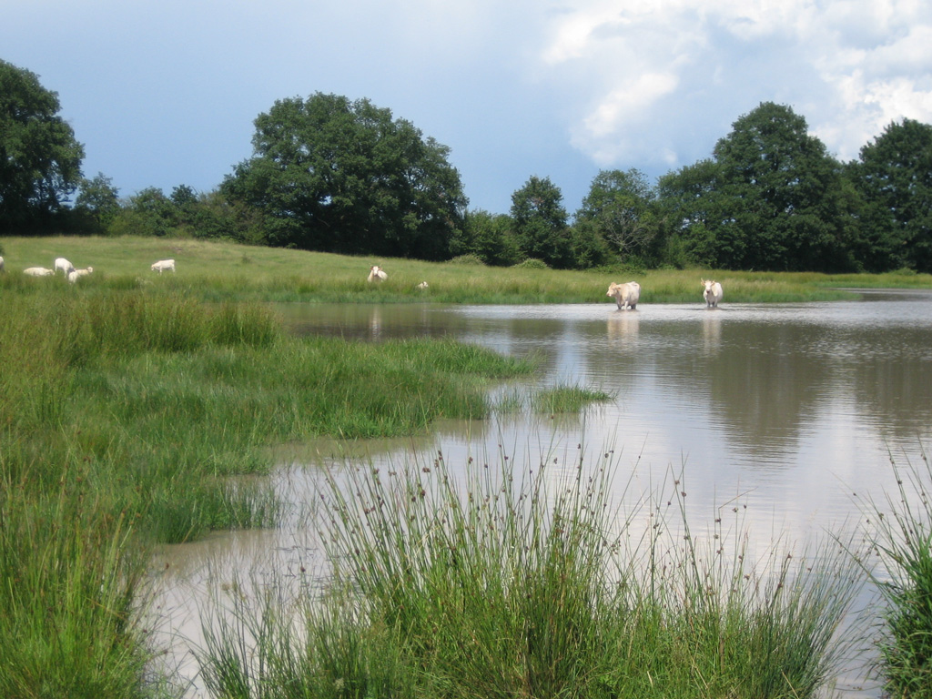
1000 lakes........ But not only !
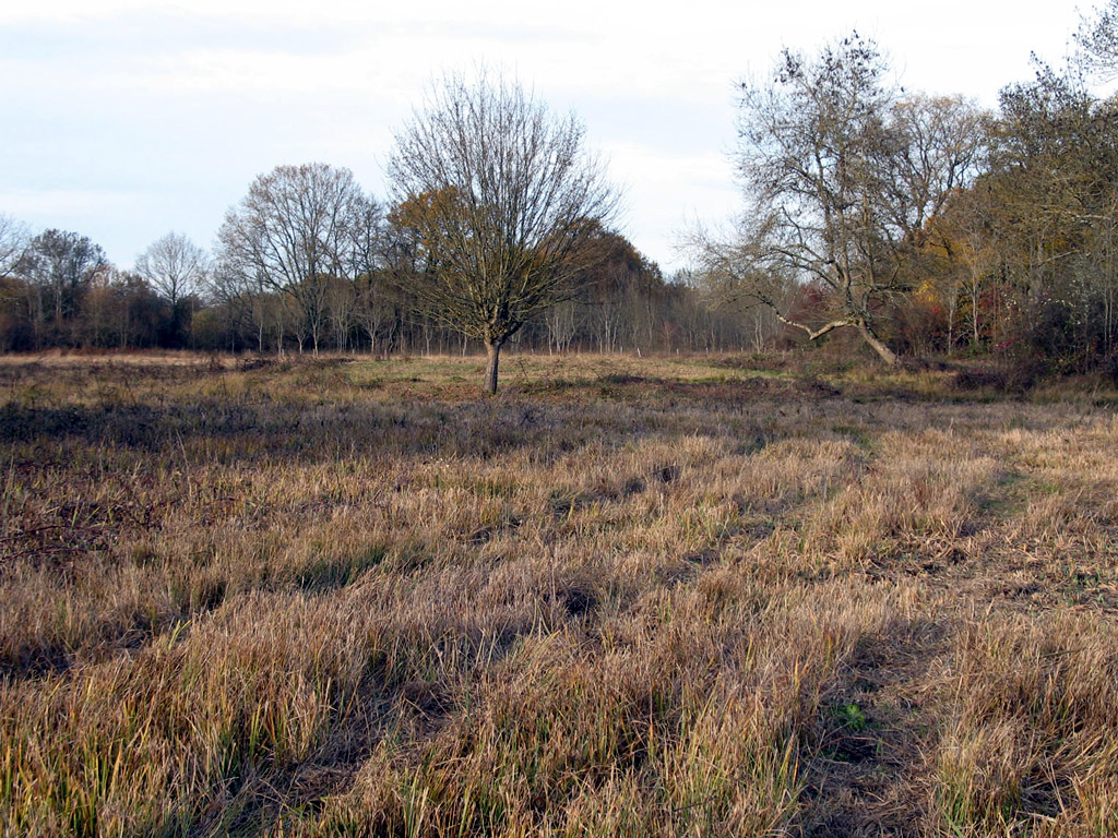
The Brenne Nature Park is composed of various natural landscapes. In the southern part, along the river Creuse et Anglin, the area is a mixture of forests, hedges and agricultural land and can be quite hilly in parts. This area is known as "La Petit Brenne", where the rivers are forming sometimes tight and rather untouched valleys which are often home to typical villages.
 In the north of the river Creuse starts "La Grande Brenne", the area which is commonly called " The country of 1000 lakes ". A real mosaic of landscapes, where water, woods, open areas and meadows are intermingling – sometimes they are dominated by the "buttons" ( a name given to the hillocks in the middle of a field or a meadow ). According to the legend they have been formed by " Gargantua" a giant which lived in this area, but their form are in reality due to the erosion of the sandstone ( they are the hard remainder of sandstone hills, leftovers from the ice age ).To discover all those different areas several itineraries are proposed, either by foot, on horse back, by bicycle or by car.
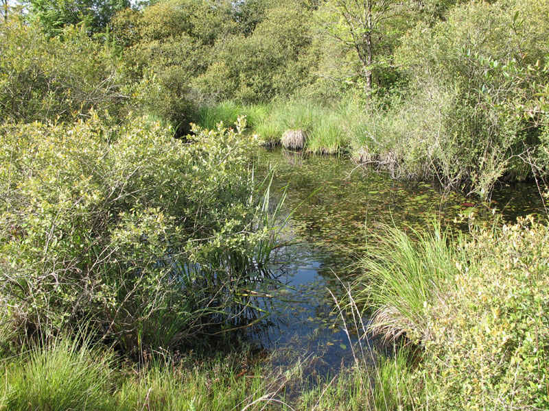
A wetland area of international importance - with its 3000 lakes the Brenne is one of the biggest inland areas of this type in France. Its clay soil, rather poor in nutrients, are the reason of the existence of the many lakes (called:"étangs"). In actual fact, their creation is purely artificial and for this reason preference is given to cattle rearing, rather then to crops.
Those lakes are traditionally used for fish farming:: 2000 tons of sweet water fish are collected every year between October and March. Amongst several local products the visitor can discover carp and the "Pouligny-St. Pierre" ( a goats cheese in form of a pyramid ), which is one of the rare goats cheeses who has an AOP (a quality label = Appellation d'Origine Protégée).
 Being preserved and protected, this territory offers ideal conditions for the reproduction of various migratory birds, of which the majority spent the winter in Africa. Of the 267 species who are finding food and shelter here, 150 are nesting birds. This area contains also the highest population of the " Cistude d'Europe", an endangered sweet water tortoise. The Brenne Nature Park is also home to many insect species, particularly various kinds of dragonflies.
 The public bird hides and the various nature discovery trails allow Nature observation without disturbing the wildlife. More then 250 guided outings are planned throughout the year, some of them are adapted to children. (Ask at the Maison du Parc, 02 54 28 12 13 for further informations)
The Park has also a rich architectural heritage although sometimes not well known. (in the area you can find old, little traditional houses which consist of only one living space as well as various Châteaux: Château de Bouchet, Château d'Ingrandes, Château Naillac or Guillaume and the remarkable Abbey of Notre Dame de Fontgombault ). Buildings who's colors are changing from different shades of red of the sandstone to the white of the chalkstone or to the multicolored version of the sandstone in white or grey.
Created in 1989, the aim of the "Brenne Regional Nature Park" is to work for the preservation of it's exceptional natural heritage with the creation of environmentally friendly activities .
Legend of the "Gargantua"
"The giant Gargantua had to cross the Brenne to go from Tours to Limoges. Despite his long legs with every step he sunk further in the mud. His giant feet were soon covered in mud and became to heavy to walk. From time to time he shook his boots to get rid of it. The amount of mud fallen from his boots was enough to form every time a " button". (a sandstone hillock)
A little history of the territory
From the forest to the lakes
Long before the "Brenne Regional Nature Park" was created or even acquired the international "Ramsar" status for its important wetlands, since centuries already the Brenne has been an area with specific particularities. Over time it has been specified as a unique territory due to its social and environmental history.
The monks in the " Saltus" or the " Land of the buttons" Most likely written in the 10th century, the tale of "Saint-Cyran", the founder of the abbeys of Méobecq and Longoret in the 7th century, mentioned the existence of a region, named the "Saltus Brioniae", situated on the borders of the Touraine, the Berry and the Poitou regions. An area which was called "wild and humid" by its inhabitants. Thanks to "Palynology" (information acquired using pollen studies), it can be assumed that this area had a very different environment and wasn't necessarily humid. As to the name "Brenne" – it's origin is unknown, but could be linked to the existence of the "buttons", those small sandstone hillocks which are scattered throughout the area.
A small history of iron and steel production in the Brenne
Before the Brenne is mentioned in written documents, archeological remains give an idea what the landscape might have been before the middle Ages. There is much proof of early human presence (some are even under the surface of the lakes). The most important activity in the antiquity was metallurgy, in particular iron production. The existence of an area of metal production in connection with the antique site of "Argentomagus" (former roman settlement near Argenton/Creuse), let us presume that this area was originally covered by extended forests (necessary for charcoal production), especially throughout a large area in the heart of the Brenne. The massive deforestation, in order to produce charcoal, might be the reason for the hydrological balance in central Brenne. It is possible that the over-exploitation of the forests, causing a barren landscape, and the development of agricultural practices during the Middle Ages, has accentuated the drying-up process of the soil. The forests and tree roots would have been acting as a regulator of the hydrological level of this area.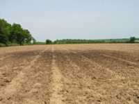 It is in this environmental context that the monks from Saint Cyran and Méobecq constructed the two abbeys in the middle of the 7th century. But, contrary to general opinion, it's not the monks who drained or created the lakes. We can find traces of it from the middle Ages onwards.
"The countries of the Brenne"
Some ancient maps show that the expression "The countries of the Brenne" was already used in mediaeval times. Several parishes which share the same name had their localization added to it in order to strengthen the belonging to an area. (E.g. Saint-Michel-en-Brenne, Mézières-en-Brenne....)
Fish farming in the Middle Ages
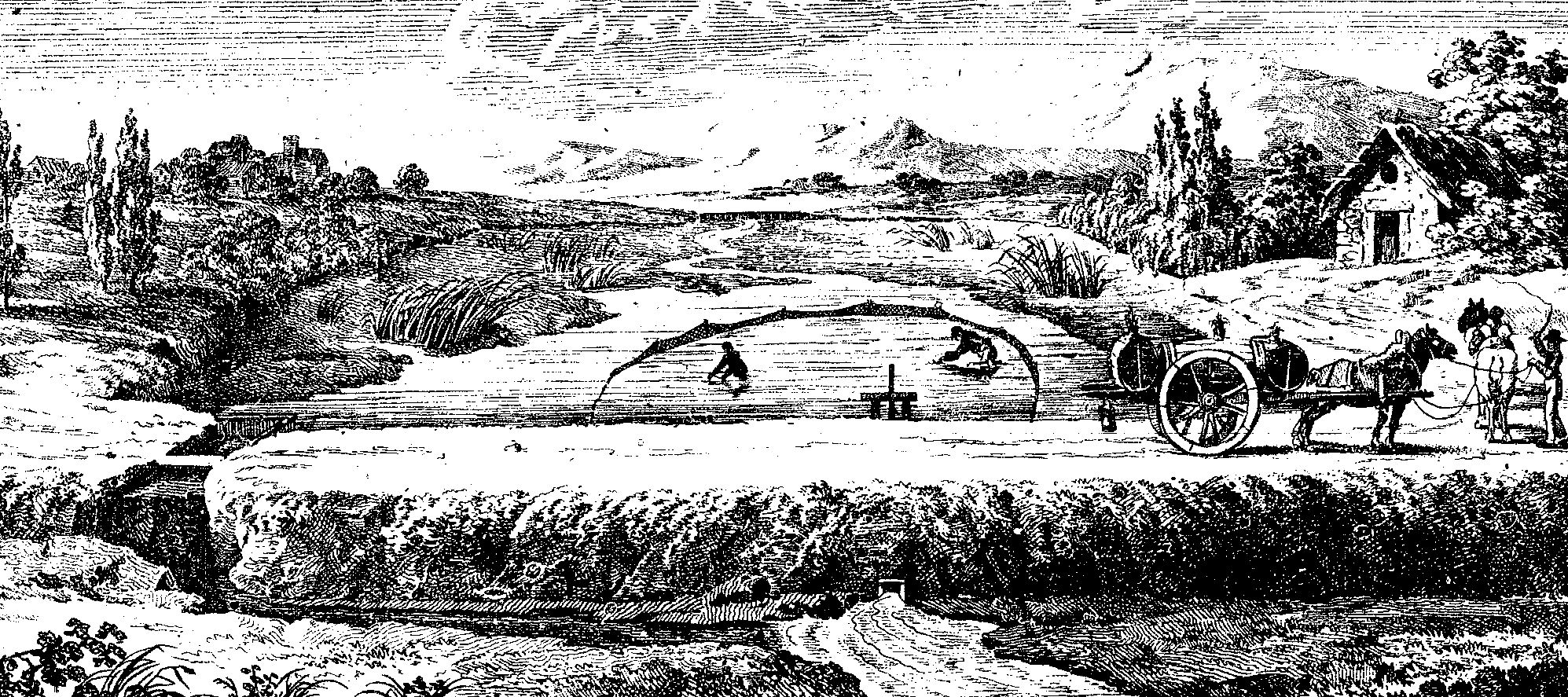
From the central Middle Ages onwards, the landscape of the Brenne takes more or less the form that we know today. Later, between the 14th and the 16th century, for the purpose of fish rearing a large number of lakes are created. In order to do so dams, using soil, are built across the numerous little "talwegs" which are very frequent in the Brenne. ( Talweg= a narrow hollow but fairly deep passage between two valleys or hills) All lakes are man-made and the arrival of a fish from central Europe, the Carpe from the Danube Delta ( Cyprinus carpio carpio ), has accelerated the creation of those lakes. The carp was a fish very much adapted to the needs and requirements of the mediaeval population. The introduction of this highly profitable species made the Brenne a leader in its commercial and speculative rearing, an area whose poor soils made cereal growing nearly impossible. The carp could be transported alive, kept in water or wrapped in wet straw, during several days to the destination of its consumption. This advantage has been most likely the reason for the success of the fish rearing tradition in the Brenne.
From the, so called, "Modern times" onwards various testimonies (non-written stories, travelers reports, old maps, etc.) are proof that before the Brenne was identified as" a country with forests, meadows and heathlands" it was described as one with "many lakes". The fish-rearing landscape had been created. However, the disappearance of old forests and the creations of lakes in the middle Ages did not course an environmental degradation. Those important changes had a positive influence in the increase of the biodiversity in the Brenne, a fact which we can observe today.
The " Brenne", a " bad" area
The 19th century is particularly difficult for the Brenne, it has been classed as a "bad country" before. In 1789, the complaint books of the parish of Méobecq mentions already, although a bit exaggerated, the bad condition of the land ("Our parish is nothing else than a desert filled with lakes, infected marshlands and heathlands"). During the tumultuous period of the French Revolution constructive plans to dry up the lakes, like stipulated in the law "14 frimaire an II/14th December 1793", could not be implored. But the perception of the Brenne as a "bad country" is mostly due to the memories of the prefect Dalphonse, entitled "Statistiques du département de l'Indre" , published in 1804, and it is mentioned by most of the scholars of the Berry region. Nowadays, this negative picture of the Brenne, like that described by this writer, is considered as an exaggeration, it is an indication of the mentality of this period towards wetland areas.
Doctors, engineers and local politicians were fixed on hygiene and positivism and were interested, like par ex. Dalphonse, in problems like the "lack of cleanliness in the Brenne". They called this area "The wound of the Indre" and even of the center of France. This question was in the heart of discussions and led to a rethinking of its territoriality. They tried to blame this negative approach on its agricultural practices and onto the actual hostile nature of this area.
In the middle of the 19th century the region entered a period of "sanitation", which indicated more the general wish to transform the marshlands of the Brenne, because in reality the majority of the lakes, pointed out since the French Revolution, are remained untouched until the next century.
The commercial fish rearing in the Brenne The fish farming industry, in crisis since the end of the 18th century, was restarted by fish farmers and lake owners only from the 20th century onwards. At this point a modernization of carpe rearing practices is implemented in France. With those changes the Brenne entered into a period of commercial fish farming for the first time. Fish rearing practices, including fish rearing nurseries, and a different way to manage the lakes have been copied from Central European countries. New carp species with a "rapid growth" have been imported et interbred in order to create the famous "Carpe Royale".
The region as a "Natural region"
In the 19th and 20th century the popular perception of being called a "country" has been progressively replaced by an impression of being a "Naturel region". With this new concept, the emphasis has been put on geology, vegetation, inhabitants, landscape and the choice of various agricultural practices. This positive change was the result of a new scientific approach.
From the point of view of the geologists, the Brenne is a territory which is historically and characteristically very different to other geological areas in the center of France. It is a part of the Berry region where the sediments of the "basin parisien" have been covered by clay and sand deposits, which contain in certain areas "ferruginous" (= iron) concentrations. At the beginning of the 20th century, the Brenne was still considered as a country bordering the Touraine region, despite being geographically in the Berry. The geographer Antoine Vacher described the Brenne as a territory which defines a unique area and an exceptional region worthy of natural interest: the "Champagne berrichonne".
With a certain irony we now can say that social perception of the former "poor region" has changed completely. The notion of a naturel region in the Berry was approved by the state in the middle of the 20th century. According to geology, landscape, social habits or regional identities the division into districts or cantons is however not locally coherent. To correct this, ministerial decrees dated 07/01/1955 and 13/01/1964 set the limits of the four naturals regions. They divide the 6790 km2 of the department of the Indre department into: "la Champagne Berrichon", "les Boischaut", "les Gâtines de l'Indre" and "la Brenne". The territory of the Brenne includes a total of 51 parishes and covers an area of 146 687 ha. This area reunites three big zones: "La Grand Brenne"," La Petit Brenne » and « La Queue-de-Brenne ». The "Brenne Regional Nature Park", created 22th of December 1989, offered this region a new identity, but that's another story......
What we need to remember
Historical and archaeological researches have shown that we must change the original concept of a wetland area as a designated zone and as "naturally" marshy. Two major rural activities have profoundly changed the local environment. The traditional landscape has, to a large extent, been formed by more then 2000 years of iron production and by at least 600 years of fish farming, based on carpe rearing. Due to its important economic impacts it seems that this fish has played a decisive role in the vocation chosen by the Brenne. The lakes have found their place in this area, in parts thanks to its unique landscape. The current condition of the wetlands is in actual fact the result of choices made in the past. This legacy is important and the remarkable biodiversity of the Brenne is the result of special edaphic conditions. It is important to point out, that this is most of all due to the transformation of the environment by its former inhabitants in order to adapt it to their vital needs.
A little bit of the Brenne's geology
The superposition of the various layers of rocks resembles the" closed pages of a book. "Every page represents a different phase in the geological history of the region. The first pages are the most ancient ones, those of the borders of the "Plateau d'Aigurande". The last pages are the most recent ones, those of the Brenne in the tertiary. The last page of this book represents the actual landscape.
An old mountain chain
The geological history of the Brenne starts with the remainders of the chain "hercyniene", a mountain chain formed towards the end of the "Primaire", 250 to 300 millions of years ago.
During the "Trias", about 245 millions of years ago, we can talk about the beginnings of the second phase/ "Secondaire". The "basin de Paris", a flat and submerged area, in which rivers and streams spread multicolored sands and where the sea, arrived from the east, tried to cover the region. This could not be completely accomplished because of the remainders of the "Hercyienne" mountain chain. This resulted in the fact that the sea did not reach beyond Châteauroux.
A warm sea
The sea-level came back from the beginning of the Jurassic period (200 millions) and stayed, like in vast parts of Northern Europe, during 60 Millions years. The sea leaves chalk (shells) deposits on the coastline, similar to those which are currently forming in the Bahamas, but also in deeper sea levels (corrals).
From the swamps to the dinosaurs:
Towards the end of the Jurassic period (145 millions of years ago), the sea withdrew from the region and left behind vast lagoons. This mixture of landscapes (varying between wetlands and dry parts) stayed until the early cretaceous period, the climate was warm and humid. Layers of iron formed on the relief. It promoted the creation of floodplains and marshlands which were home to many different species of dinosaurs and in particularly of herbivores.
The return of the sea and of the chalk:
Around 95 millions of years ago, the sea tried to regain lost territory. The first maritime deposits are green sands, followed by kaolin rich clay to little oysters. Those sediments were quickly relayed by the first chalk deposits. The sea of the later cretaceous period covered the totality of the Paris basin and well beyond during about 30 million years.
An aggressive climate
The sea of the cretaceous period withdrew about 80 millions of years ago and the entire region surfaced. It was again exposed to a hot climate, nearly tropical, which was particularly aggressive to the existing rock formations. Chalk stone and chalky rocks layed on a clay foundation are were exposed to climate aggression. This process lasted about 40 millions of years, enough time to form a thick layer of clay produced by the rocks of the Primaires. This process dissolved the surface of the chalky rocks and put a Karst region in place. It is at this period when the red sandstone of the Brenne was formed in the southern region, a stone already which was already present in the chalkstones of the Jurassic period. In the northern part the clay sand mixed with Flintstone formed the Tufa.
The birth of the Brenne
The area of the Brenne (the" Little" and the "Big" Brenne) has been formed about 40 millions of years ago. At this period of the Tertiary a slow collapse of the Substratum created a vast bowl, capable of capturing the muddy waters of the streams descending the" Massif Central ". Clay and clay rich sands accumulated in those depressions of the landscape, natural hollows which are forming most of the territory of the Park. Between 40 and 25 millions of years ago those deposits were the origins of the "terres grasses" of the Brenne. They are also called "siderolitic fields" because they contained often iron, and are former river deposits mixed with soils with a concentration of iron oxide. Those latter soils are distinguished by a hardened layer with a high iron content. This provides this last layer of the soil with a very high resistance against erosion. This solid upper part of red sandstone is at the origin of the "button".
"Not too far from the beach"
In the Miocene period, about 20 millions of years ago, the sea tried to take over this region for the last time. Coming from the riverbed of the Loire, this attempt has been stopped by the reliefs of the "Ligeuil-Ciran". Therefore "the beach" can be found about 10 km north of the park.
The creation of the actual landscape
The geographical history of the Brenne finished towards the end of the Tertiary period (from 20 to 2 millions of years). During this time the Brenne was completely raised and the rivers spread freely over a vast wooded bog land which had not yet been cut through by actual valleys. Those rivers left large sandy- clay areas and fossilized wood behind them. About one million of years ago, during the ice age, the riverbeds dug into the plateaux and created deep valleys. Nevertheless, the glaciers never arrived until the borders of the "Berry". During the Ice ages the plateaux were exposed to erosion and a part of the sediments were blown away. The sandstone however resisted and the residues/hardcore formed the relief of the Brenne: the" buttons"/the hillocks. Sandy river terraces were formed whilst the actual landscape was created, with the subtle differences that we know today.
The materials of the subsoils are therefore very varied. Direct connections exist between subsoils, soils, climate and vegetation. On the surface of the Brenne it's not rare to find a big diversity of soils and vegetation. The rich botanical heritage of the Brenne park is linked to it's long geological evolution.
Landscapes
A remarkable diversity of landscapes
The big geological variety of the territory, due to the different kinds of soil, is the reason for the existence of 6 very different landscape entities. In analysing the landscapes in greater detail, one can distinguish many sub-entities and transitional landscapes.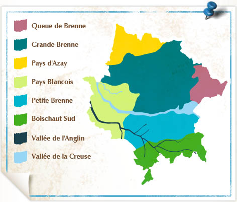
The "Grande Brenne"
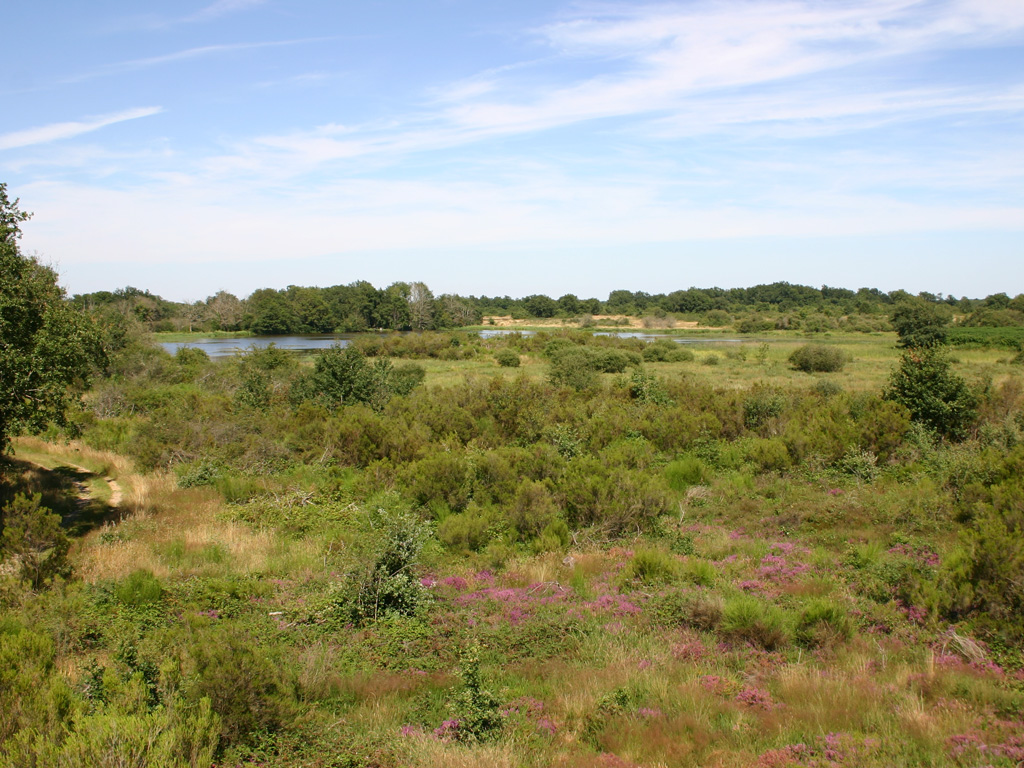 The "Grande Brenne" or the " Brenne of the ponds" is formed by a mosaic of landscapes where water, forests, heathlands and meadows, which are sometimes dominated by sandstone hillocks, are intermingling.
The reason for this lies in the erosion of the sandstone: the softest types have disintegrated and have formed the sandy layers that can be found today on the surface of the clay. The most resistant ones have formed the ""buttons", the sandstone hillocks. The poor soils consisting of clayey sandstone, which are difficult to exploit because too humid in winter and too dry in summer, are the explication of the creation of the lakes (all are artificial). Importance is also given to livestock breeding on land unsuitable for crop farming.
The diversity of the natural environments is at the origin of the great ecological wealth of the Brenne.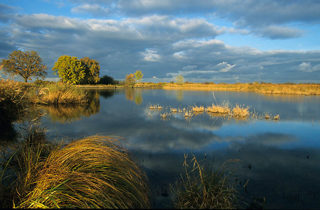
In the 19th century, the Brenne, poor, isolated, with a very low population density, has been frowned upon as this text of George Sand* shows: (but the "wild character" of its landscapes has been known already) (*George Sand is one of the most important female French writers of the 19th century)
"On the whole, this county (the Indre) is furrowed by two beautiful valleys, the one of the Indre, which gives it its name, and those of the Creuse with the picturesque ravines of its torrential tributaries. But, between those two regions, fresh and rich, one united plateau, sad, unhealthy and poor: that's the Brenne.
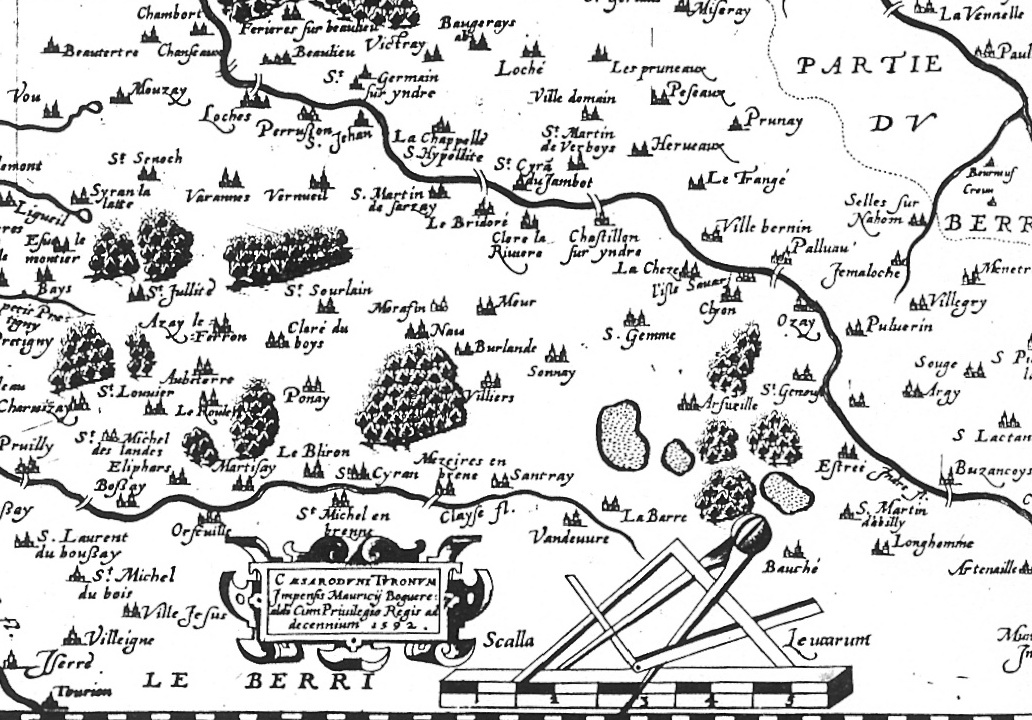
If you look at the Brenne which figures on the old illuminated maps of Cassini, the physiognomy of a country so wild is tighten your heart; no paths, no villages, enormous open spaces with a church tower, without a farm, without a little grove. Everywhere are endless amounts of ponds strewn in the heather? The new departmental maps don't show the Brenne in a much better light.
However the Brenne is neither so ugly, nor so dead like it is appearing in its descriptions. In the eyes of the painter or the writer, that flat territory, flooded in a thousand places, with a crazy vegetation of useless grass, which are fattening in the silt, does not lack of character. There is even a certain desolated poetry in those reed plains scorched by the heat wave.
It's like being far, far away from France, in some desert where man would not have yet penetrated.
If we can find a mound, a dungeon, the Bouchet castle, for example, and the view is hovering over a vast area, this is also as beautiful in its way, as our beloved paintings of the Indre, the *Creuse or the Bouzanne." (*3 rivers of the region)
Gerorge SAND: "Le cercle hippique de Mézières-en-Brenne par un habitant de la vallée noire à la suite d'Isidora"
 The «Grande Brenne» has been marked by clearings in the 1980's and 1990's. The reason for this lies in the agricultural abandonment, the decline of livestock and the development of hobbies like hunting. Those changes are on the increase since about ten years. Furthermore, the search to raise the pond's productivity has caused a regression in the aquatic vegetation. Those noticeable mutations in the landscapes are causing strong pressure on the ecological balance of this environment who is equally perturbed by the proliferation of invasive exotic species like the Water-Primrose ((Ludwigia) and the Red Swamp Crayfish.
On the other hand, in the periphery of the "Grande Brenne",livestock rearing has however increased. Where soils are suitable, certain sectors are even able to increase their crops harvest.
The "Queue de Brenne"
 The " Queue de Brenne" consists of fewer ponds then the "Grande Brenne", but is showing the same soil characteristics . This area is wooded in its northern part and crops are on the increase in it's southern area.
The "Petite Brenne"
Situated south of the Creuse river, it is equally home to ponds, but they are less frequent than in the "Grande Brenne" and the plateau is covered in parts by large forests. The terrain is an intermediate between the hills of the "Boischaut" to the south-east, buttress of the Massif central and the plateau of Le Blanc to the north-west. Certain progressions of forests and woodland can be observed around the ponds.
The " Pays d'Azay et le Pays Blancois"
 The Pays d'Azay is a crop growing area attached to the agricultural region of the " Boischaut nord". The forest of Preuilly and the valley of the Claise are the two main landscape elements of this entity. The landscape of the valley of the Narçay creates a distinctive border between the still wooded Brenne and the large areas of crop cultivation where hedges have disappeared.
 The "Pays Blancois", strongly characterized by valleys cut in chalk stone, is indicating the border between the Berry and the Poitou regions. The landscape is varied: farm plateaus and valleys alternating with gardened landscapes, grasslands, rocky cliffs and steep wooded slopes.
The "Pays Blancois" and the "Pays d'Azay" have been touched by land consolidation and therefore changes in their landscapes due to agricultural evolutions (in the second half of the 60's, beginning of the 70's). Gradually the landscapes became more unified. The consequences of the intensive exploitation of fertile soils are the expanding of agricultural parcels, the almost disappearance of hedgerows and the cultivation of the valleys.
Boischaut sud
The mixed landscapes of the "Boischaut sud" are to a large extent fragmented by a structure of still dense woodlands, in particularly in steep areas; the hillside relief is quite pronounced especially in the south-east; the hydrographic network is cut deep, made of waterways (the river Anglin and its tributaries) and of some ponds. One can find three sub-entities: the woodlands of the "Boischaut-sud" to the south-east, the regrouped woodlands of the "Terres Froides" in the Poitou region (open woodlands) to the west and the transitional woodlands, who are starting to open up, to the north. Those three major groups are being crossed by a system of different sized valleys.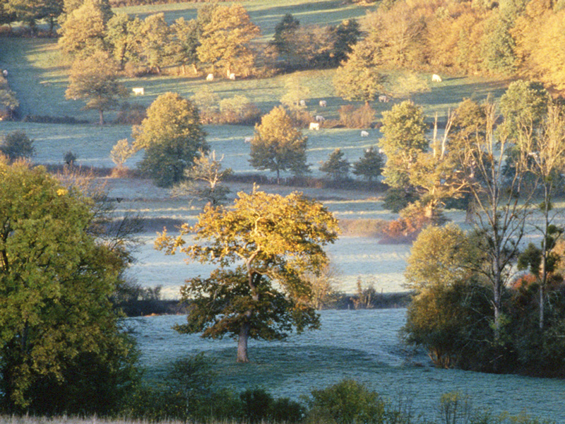 The principal activities remain sheep and goat breeding and intensive cattle rearing. The woodland covers a remarkable diversity of natural habitats, amongst some dry grasslands, moorlands (dry, humid and mixed), thickets and many ponds. The hedgerows and small forests play an essential role in the diversity and the effective of numerous species. An entire hedgerow with its embankment and its ditch houses an abundance of various avifaunas. It is home to a wealth of plants, with on average nearly eight tree and shrub species per hedge.
The English oak(Quercus robur), the Sessile oak (Quercus petraea) and sometimes Chestnut are the most common trees. Amongst the shrubs Blackthorn and Hawthorn are the most common ones. In the shallow areas one can rather find the European Alder (Alnus glutinosa), Ash (Fraxinus) and the Ginger Willow 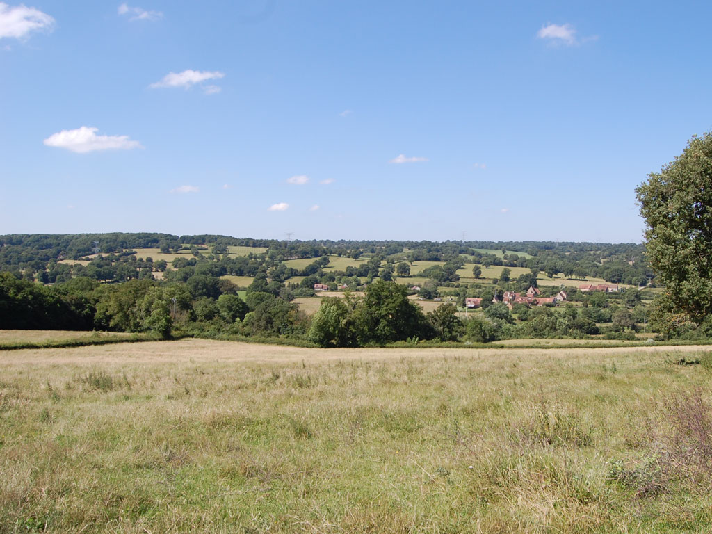 (Salix atrocinerea Brot). The Field Orme (Ulmus minor), who has been the emblematic tree of the hedge, has diminished a lot because of the Dutch elm disease. In the areas most suitable for agricultural use (essentially fertile plateaus), the diminishing of the hedgerows is critical. The woodland area has increased considerably during the last 50 years and one notices that the percentage of actual trees in the hedgerows is reduced. Those who are still existant are mainly trees dealt with in the traditional way (trees pruned in the "têtards"style and pollarded). Today the network of the hedges is less dense and they are less joined together. This is affecting their ecological interest. But despite this developpment, the hedgerows are staying relatively dense. This shows that a balance between economical necessity and the conservation of those hedges is after all possible.
The valleys of the Creuse and the Anglin rivers
 Between Saint Gaultier and Tournon-Saint-Martin, the Creuse,a dominating river with few tributaries, offers a dividing line in the landscape between the northern and the southern part of the Park. Upstream of Le Blanc the river meanders in a floodplain bordered by wooded hillsides, while downstream the river is bordered by limestone cliffs. On the edges of the plateau lean meadows have developed on the limestone or "calcareous grasslands". Still in the same text, George Sand is pointing out the beauty of its landscapes: "If he (the traveler) meets the Creuse near Le Pin and if he descends until Fontgombault, he is crossing the lovely area called " Little Switzerland",and he will have roamed the most beautiful part of the county and one of France's most smiling ones "
The Anglin river has many little tributaries, especially in the south, bordered by wetland meadows and occasionally bogs.
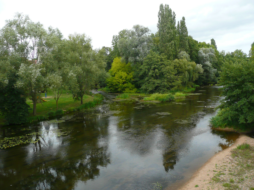 The surroundings of the rivers Creuse and Anglin are preserved throughout, but the landscapes are suffering from the abandonment of pastures, of the cultivation of the valley bottoms and of the transformation of certain parts into scrubland. The riparian forest is still well existent, but is sometimes fragile, especially due to the development of poplar trees cultures. The hillsides have been touched by urbanization. It is difficult to perceive the landscape of valleys because very few paths are going along the riversides. With the vegetation in place, the roads, which are following the hillsides, offer only very limited views. Only bridges or canoe trips are really allow to appreciate the landscapes.
Who's who
Le Syndicat mixte
a form of joint union of the 51 communes who form the park
The "Syndicat mixte" regroups the parishes, the communities of communes, the departments of the county of the Indre and the region of the "Centre". Its purpose is the implementation of the charter, which is, in a way, its "road map".
Le comité syndical
The union's committee
All municipalities are represented by at least one delegate (by two if more then 1000 inhabitants), as well as by six delegates of the Regional Counsel of the Indre and by six delegates of the Counsel of the "Centre" Region. The "comité syndical" consists in all of ca. 70 delegates. It acts like the municipal counsel of a parish: it votes the budget and takes important decisions. Current affaires are managed by an Office of 24 appointed members.
Liste of the Park delegates 2016
The statuses of the " Syndicat mixte"
At the head of the "Syndicat mixte", an elected president as well as two vice-presidents :
 The President of the Parc
Jean- Paul Chanteguet
Deputy
 First Vice-President
Gérard Blondeau
Departmental advisor
 2nd Vice-President
Annick Gombert
Maire du Blanc and regional advisor
The consultative bodies
The working committees: nine in total, they associate the delegates, but also socio-economic actors and associations. They propose and monitor projects and actions.
 Agricultural-Fishing-Forest and Hunting Commission
presided by André Gateault
Municipal advisor of Douadic
This committee is animated by the Chamber of agriculture.
 Commission for the Economical Development of the territory
presided by Joël Darnault
Maire of Rivarennes
 Nature and Environmental Commission
presided by Patrice Boiron
Maire of Neuillay-les-Bois
 Cultural Heritage, Urban development and Landscape Commission
presided by Gilles Touzet
Maire of Prissac
 Education and Youth Commission
presided by Patrice Houssein
Deputy Maire of Lureuil
 Cultural Commission
presided by Daniel Champigny
Maire of Néons-sur-Creuse
 Tourist Commission
presided by Alain Nevière
Municipal advisor of Bélâbre
 Financial and Human resource Commission
presided by Christophe Vandaele
Maire of Vendoeuvres
- Sustainable Development Council
This is an emanation of a "civil society", whose role should be increased in the new charter, in particular to evaluate the action of the Park.
President Yves Champigny
Secretary General of the Federation of secular works of the Indre
The Scientific Council
It's a bit like a "council of the elders", composed of scientists from different backgrounds who know the territory and play a consulting role. The mission of a Park is also experimentation and research.
- Presidency vacant
The "Syndicat mixte" does not charge any taxes. A Collectivity without their own tax, the Syndicat finances its operations through membership fees (parishes, departments, the Region and the State). Other means of income are various funding of scientific programs: European funds, Natura 2000, Regional contracts, Park contracts, Contacts concerning Youth programs and programs links to sustainable development.
Technical staff
schema François MIGNET
Directeur
f.mignet@parc-naturel-brenne.fr
- Coordination between different poles
- Budget preparation
- Coordination between financial and technical partners and various institutions
Administration
 Isabelle RICHARD
Pole Manager
i.richard@parc-naturel-brenne.fr
- Coordination of the administrative pole
- Accountancy and budgets preparation
- Human Resource
 Gwenola VENAULT
Accountant assistant
g.venault@parc-naturel-brenne.fr
 Christine DEBERGE
Secretary
info@parc-naturel-brenne.fr
- Reception, switchboard and secretariat
- Various administrative tasks
 Stéphanie LAVAUD
Secretary
info@parc-naturel-brenne.fr
- Reception, switchboard and secretariat
- Administrative tasks linked to the European program " Leader"
 David BALLUET
Maintenance and Service Agent
- Maintenance of Park different facilities and sites
Communication
 Estelle BLAIN-SAURET
Communications Officer
e.sauret@parc-naturel-brenne.fr
- Coordination and communication between poles
- Press relation
- Coordination of Park events
Computing Evaluation
 Benoît PELLE
IT project manager and evaluation manager
b.pelle@parc-naturel-brenne.fr
- Coordination/evaluation of the park's actions
- Computer network administration
Climat-Energy
 Sébastien YAOUANC
Animator of the Territorial Climate and Energy Plan (PCET)
s.yaouanc@parc-naturel-brenne.fr
- Elaboration, Financial monitoring and animation of the "PCET"
Nature and environment Pole
 Sandra FERRAROLI
Head of the pole
s.ferraroli@parc-naturel-brenne.fr
- Pole coordination
- Administrative and financial management
 Benoît PELLE
Environmental officer
b.pelle@parc-naturel-brenne.fr
- Animation of the site Natura 2000 "Grande Brenne"
- Coordination of the sites Natura 2000 "Creuse" and"Anglin"
 François PINET
Ecological missions manager
f.pinet@parc-naturel-brenne.fr
- Coordination of agro-environnemental actions
- Expertise naturaliste
- Follow-up of actions concerning the fight against invasive exotic species (EEE)
 Hélène GASTÉ
Botanical missions manager
h.gaste@parc-naturel-brenne.fr
- Realization of botanical diagnostics
 Vivien AIRAULT
"Nature 2000" missions manager
v.airault@parc-naturel-brenne.fr
- Animation of the sites Natura 2000 "Creuse" et "Anglin"
- Management of the "Naturalistic Observatory" and of the Geographic information system (SIG)
 Vincent SAURET
Custodian of the Regional Nature Reserve " Terres et étangs de Brenne Massé-Foucault
v.sauret@parc-naturel-brenne.fr
- Management of the Regional Nature Reserve
- Nature animations
 Aurore COIGNET
Responsible/Fight against invasive exotic species (EEE)
a.coignet@parc-naturel-brenne.fr
- Scientific experiments
- Follow-up operation plantation «Water lilies»
 Frédérique ARDIBUS
Animateur/Management of the "Maison de la nature et de la réserve"
f.ardibus@parc-naturel-brenne.fr
- Reception «Maison de la nature»
- Nature animations
- Reception management and responsible of the naturalistic bookshop
 Emilie RENONCET
Animator-" Maison de la nature et de la réserve"
e.renoncet@parc-naturel-brenne.fr
- Reception «Maison de la nature»
- Nature animations
 Thibault MICHEL
Animator -"Maison de la nature et de la réserve"
t.michel@parc-naturel-brenne.fr
- Reception « Maison de la nature »
- Fight against invasive exotic species (EEE)
- Coordination operation «Water lilies»
 Ghislain BRUNEAU
Maintenance
- Fight against invasive exotic species (EEE)
 Simon RAVERDY
Maintenance
- Fight against invasive exotic species (EEE)
 Pascal CAILLAUD
Pastoral agent
- Herd monitoring (sheep and equine)
- Fight against invasive exotic species (EEE)
Cultural heritage, architecture, landscape, town planning pole
 Dany CHIAPPERO
Head of pole
d.chiappero@parc-naturel-brenne.fr
- Pole coordination
- Administrative and financial management
- Animation of conventions
- Architectural advise
 Renaud BENARROUS
Archaeologist
r.benarrous@parc-naturel-brenne.fr
- Archaeological inventory
- Coordination of archaeological operations and paleo-environmental studies
 Clémence LEGROS
Project manager/ Sustainable urban planning
c.legros@parc-naturel-brenne.fr
- Support for planning documents for the public sector
- Animation of landscape observations
Education and cultural pole
 Sébastien RIGAUD
Head of pole
s.rigaud@parc-naturel-brenne.fr
- Pole coordination
- Administrative and financial management
- Various cultural animations
 Christelle VIAUD
Musician (Schools)
c.viaud@parc-naturel-brenne.fr
- Musical animations in school environment
 Sylvain GUILLAUMET
Musician (Schools)
s.guillaumet@parc-naturel-brenne.fr
- Musical animations in school environment
Local development pole
 Sébastien LALANGE
Head of pole
s.lalange@parc-naturel-brenne.fr
- Pole coordination
- Administrative and financial management
- Animation of the Regional contract
- Coordination of the "ADEP – Benne Initiative" ( Help with local start-ups)
 Sophie LESAGE
Animateur LEADER (European programme)
s.lesage@parc-naturel-brenne.fr
- Development, financial monitoring and animation of the LEADER program
 Cyril CHAPELON
Agro-Tourist Animator
c.chapelon@parc-naturel-brenne.fr
- Animation of the network of local farm producers
- Coordination of the operation "A midi, c'est genial, on mange local"
 Ludivine BREGEON
Animator of the local health contract
l.bregeon@parc-naturel-brenne.fr
- Animation of the local health contract
- Territorial diagnosis
MAISON DES ENTREPRISES-INITIATIVE BRENNE
 Cécile GAGNOT
Animator Initiative Brenne
c.gagnot@parc-naturel-brenne.fr
- Communication
- Monitoring of partnerships
- Development of the structure
 Audrey GOUILHERS
Business responsible
a.gouilhers@parc-naturel-brenne.fr
- Reception, support for business projects
- Assembly of business files
 Joëlle FENESTRAZ
Secretary
maison.entreprises@parc-naturel-brenne.fr
- Reception, switchboard, secretarial duties
 Elise BRAHY
Animator/Short circuits
e.brahy@parc-naturel-brenne.fr
- Creation and development of the platform short circuits ( promotion of buying locally)
- Link between producers and collective restaurants (school canteens....)
MAISON DE L'ENFANCE
 Stéphanie SAUDRAIS
Coordinator of the "Maison de l'enfance"-
maisonenfance-parcbrenne@waandoo.fr
- Political coordination « Early childhood » for the Brenne Park
- Animator for the network of child minders
 Lucie THIENNOT
Animator for the network of child minders
maisonenfance-parcbrenne-ram@orange.fr
- Educational animations for toddlers
- Administrative assistance for child minders and parents of the territory with no fixed address
 Corinne CORNEIL
Toy "librarian"
maisonenfance-parcbrenne-ludotheque@orange.fr
- Reception toy «library"
- Management of the loan of games and toys
- Animations for the very young
Pole tourism
 Géraldine CHANCEL
Head of pole
g.chancel@parc-naturel-brenne.fr
- Pole coordination
- Administrative and financial management
- Tourist information/communication
Cyril CHAPELON
Animator hiking/walks and "Marque Parc"
c.chapelon@parc-naturel-brenne.fr
- Development of hiking/walks ( Bicycle, Horse, Mountainbike....)
- Development of the quality label "Marque Parc" for tourist accommodations
 Valérie LE MERCIER
Tourist adviser
tourisme@parc-naturel-brenne.fr
- Reception/tourist information
- Data collection
- Secretarial duties
- Economic observation of the territory
 Justine RIDET
Tourist adviser
j.ridet@parc-naturel-brenne.fr
- Reception/tourist information
- Data collection ( tourist offers, animations, tourist brochures...
- Secretarial duties, digital animator
- Reception management/planning

Monika BRUCE
Tourist adviser
tourisme@parc-naturel-brenne.fr
- Reception/tourist information
- Data collection ( tourist offers, animations, tourist brochures...
- Secretarial duties, digital animator
- Reception management
Nature
An exceptional natural heritage
The Brenne Regional Nature Park has an exceptional natural heritage.
The various listings and the number of classifications or inventories regarding its ecosystem or species (animal and vegetal), are witnesses of an exceptional ecological wealth. Incontestable facts which are recognized on a national, European and international level.
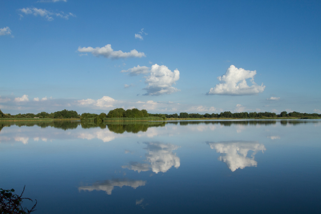
 According to the RAMSAR convention (since 1991 nearly the entire surface of the Brenne is classed as a wetland area of international importance. After the lakes of the "Champagne humide" the Brenne is the second biggest wetland zone in France.
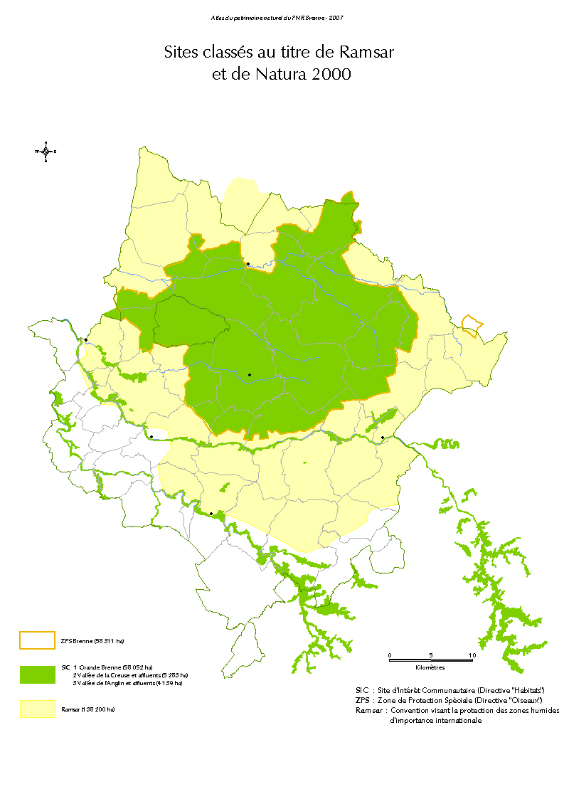
 However, the area is recognized on an European level because the Brenne contains four designated "NATURA 2000" sites:
- 3 zones of Special Conservation (ZSC) under the title "Habitats": the valleys of the Creuse and the Anglin and the "Grande Brenne".
- 1 zone of Special Protection (ZPS) under the title "Birds": the Brenne which superimposes the "ZSG of the Grande Brenne"
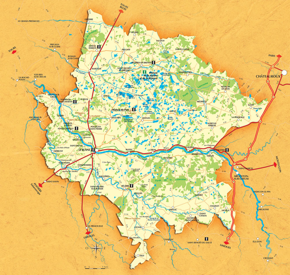
The following map summarizes the zoning of this territory:
The Brenne: a wetland area of international importance
 In the Brenne offers several types of wetland areas:
 Running waters (springs, streams, rivers.....) can favour the creation of wet habitats like peatlands or wetland meadows.
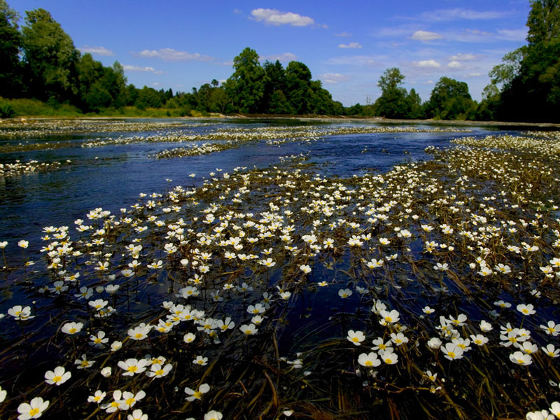
- Stagnant waters (ponds, drain ditches....) The creations of the ponds are at the origin of the developpment of special natural habitats in its immediate surroundings like marshes, moors or wetland meadows, so characteristic for the Brenne.
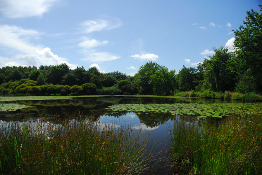
The park is home to about 4000 lakes and ponds, which means about 9000 ha of water. Their creation is entirely due to human activity, reminding of the close connections between human societies and mankind. The early ones have been created for the fish production from the middle Ages onwards; ponds have been dug for agricultural purposes, like to provide drinking facilities for cattle. The ponds can also be the result of the exploitation of old Marl pits.
Where the ponds are forming a network, like it is the case in the Brenne, they are home to a metapopulation of many aquatic plant species, of invertebrates and amphibians, playing a crucial role in the conservation of the biodiversity of the landscape.
WILDLIFE
The Park is home to more than 2300 identified animal species.
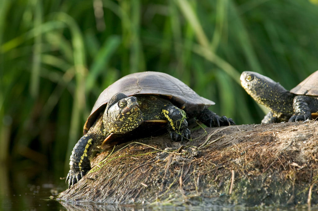
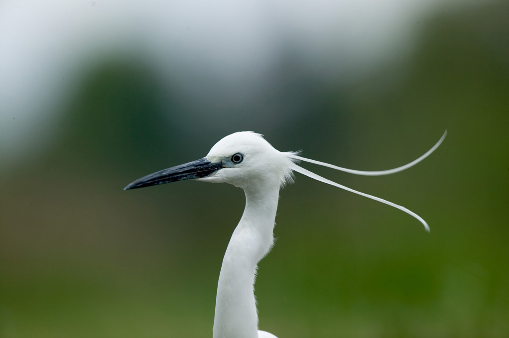
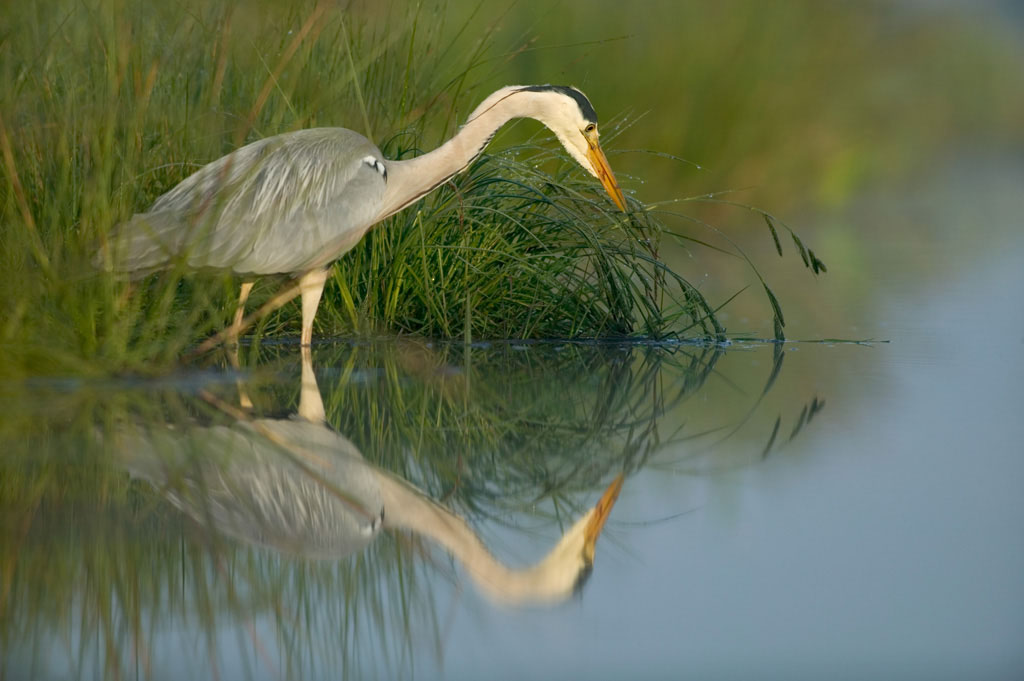
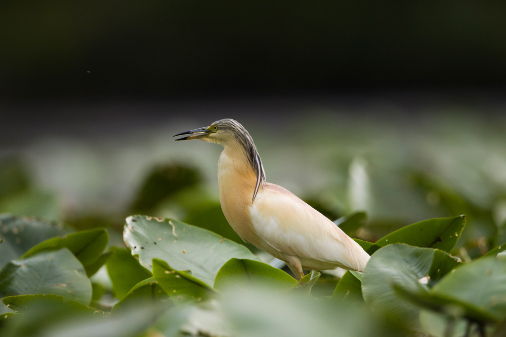
Open your eyes and you might discover a "Cistude d'Europe (European pond turtle) taking a sun bath during the warm season or admire the Whiskered terns in flight.
Mammals
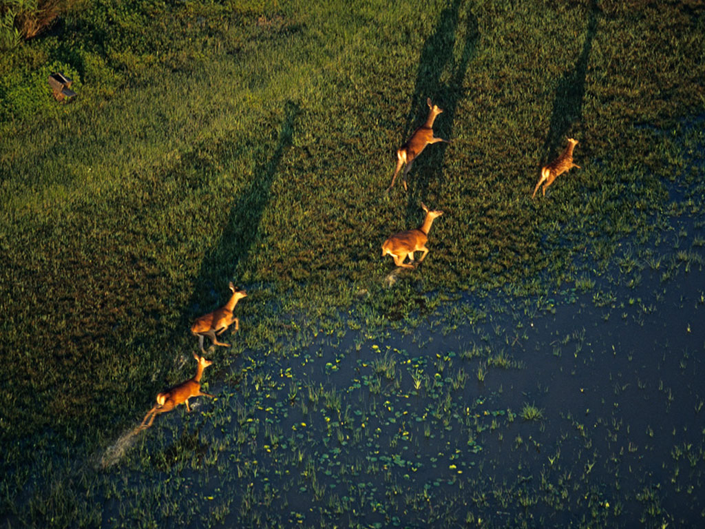 One of the characteristics of the park is the presence of a large population of big mammals (Stag, deer, and wild boar which is on the increase). As of today, 27 protected species of the 68 accounted for in France have been identified in the Park.
Special surveys have identified 22 bat species; as to micro-mammals, like the Amphibian vole, they are not yet widely known.
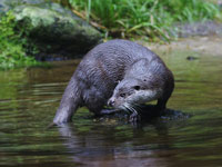 Species like the "Common genet" and the dormouse, the "Campagnol de Gerbe"(a vole species), can be observed while otters and beavers have been again observed in the Park.
Birds
 Birds are undoubtedly the most known group in the Brenne and the group the most identified thanks to important counts ( BIROE, WETLAND...). Numerous observations since the 1980s confirmed the importance of the wetland "Brenne" as a habitat of rare bird species.
Water fowls
 Recognized on an international level due to the quantity and the diversity of species presented, the Brenne is on the 4th rank of the "French wetlands of International importance", according to the classification of the "UICN". The Brenne is visited or is home to ¾ of the 365 protected French bird species.
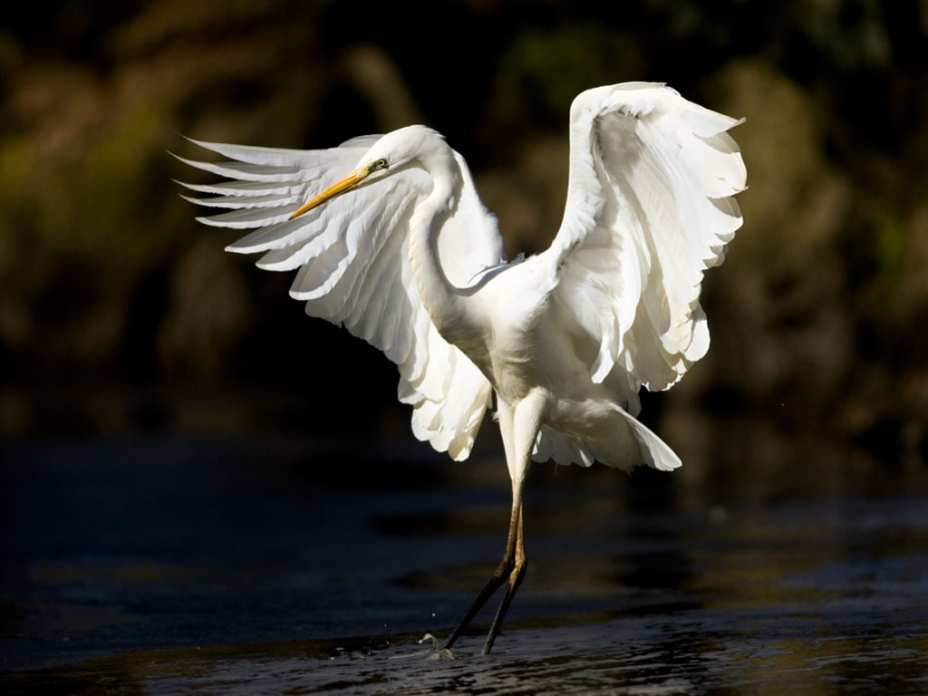
The biggest interest lays in the breeding species, like the Black-necked Grebe, the rare Eurasian bittern, the Night Heron, the Western Marsh Harrier, the Purple Heron, the Whiskered Tern, the Black Tern, etc.
During the winter months, the lakes are regularly home to 12 000 ducks and teals, 900 grebes, 3000 coots, 900 Great cormorants, 300 Great egrets, 35 000 lapwings and plovers, which are joint by some " Garot à l'oeil d'or", "Harles piette et bièvre", shell ducks and lately by the White Tailed Eagle.
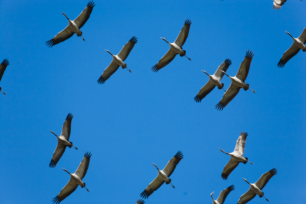 During the migration period many waders can be observed (Ruff, Black-tailed Godwit...) and thousands of the Common Cranes are flying over the Brenne when the weather is getting colder. Since a few years many are staying here over the winter.
Land birds
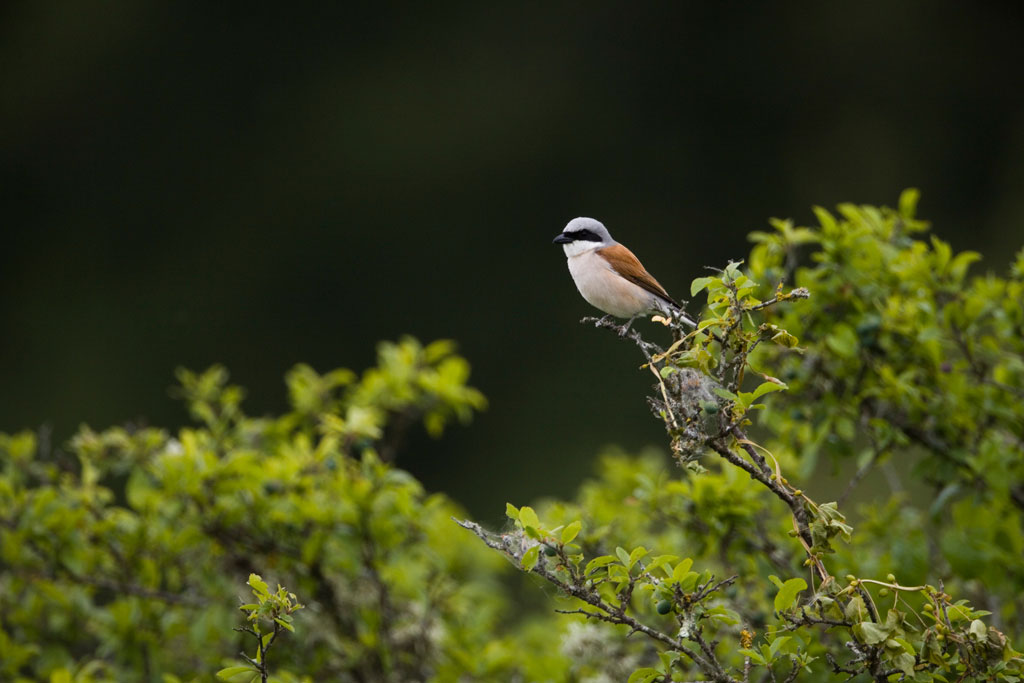 Up to 116 bird species nesting in the Brenne can be observed: Nightjar, Honey Buzzard, Booted Eagle in forest areas; Curlew, Stone Curlew, Montagu's Harrier, or the Woodlark around farmlands; the Dartford Warbler and the Hen Harrier around moor lands.
Reptiles
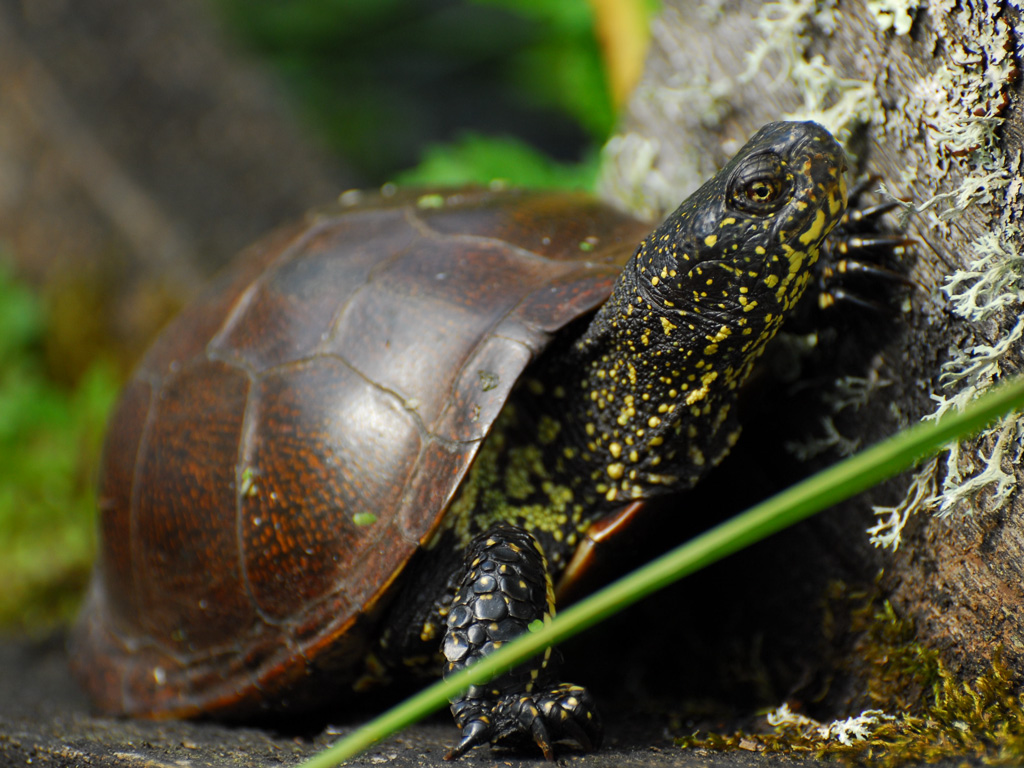 The park is home to 11 of the 37 of France's native protected reptile species.
In the absence of a systematical reptile inventory of the territory, the European Pond Turtle (The Cistude d'Europe) alone represents nearly 2/3 of the observations until today. This emblematic animal has found here a real place of "appreciation". The actual population of the Brenne is ca. 70 000 individuals, proof that this area is one of the most important regions in France for its protection.
Amongst the other 10 species presented, the Asp Viper, the Grass snake, the Yellow and Green Viperine water snake and the Green Lizard are widely presented.
Amphibians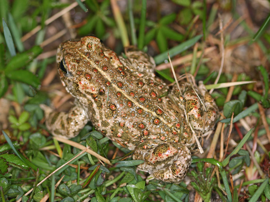 Nearly half of France's 35 Amphibian species are present in the communes of the Park, amongst them the very rare Common spadefoot, marbled Newt and Great Crested Newt. Large populations of Green frogs can be found. Green Tree frogs, Natter jack toads and Common Parsley frogs animating the lakes during the reproduction period. Some amphibians, like the Yellow-bellied toad, are now threatened with extinction due to the destruction of their habitats.
Fish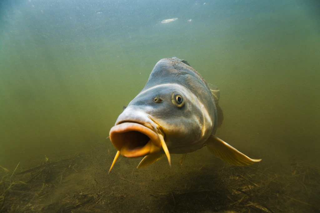 Across the various water ways and the lakes 32 fish species are listed. Amongst them are of course locally reared species: Carp, Roach, Pike.... but also introduced species like Black bass and Zander.
The Lamprey and the Brook Lamprey, the Chabot fish (Cottus gobio) can be found in the water ways of the territory. In 2001 the suppression of the dam of the "Maisons rouges" on the Creuse river has favored the return of the Great Shad and in 2010 Salmon and Trout have been observed.
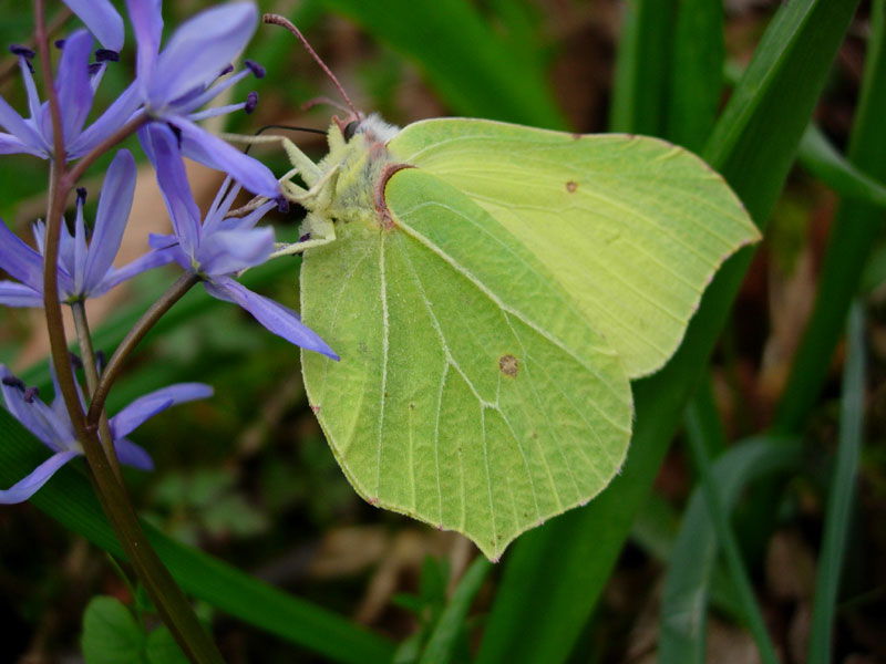
Insectes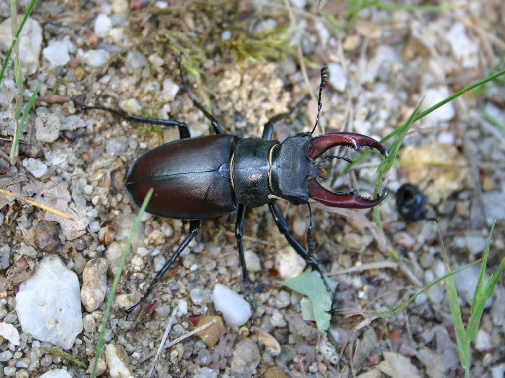 Around 3000 species, divided in around 30 sub-species, are actually listed. They are mainly Butterflies (Lepidoptera) and beetles. An estimation indicates the presence of around 12 000- 15 000 insects presented in the Brenne ! Of particular importance are the presence of 62 dragon fly and damsel fly species of the 91 accounted for in France. One can also observe big populations of Cetonids and Stag beetles (Lucanus Cervus) who find a home in old oak trees. Rare butterflies like the" Phengaris Alcon", the "Large Copper", the "Marsh fritillary" and more recently the "Eriogaster Catax" can be observed.
Mollusks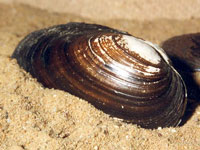 Mollusks are divided in bi-valves (mussels, oysters....) and gastropods (snails, slugs...). From the 60 protected mollusks species of France, only one can be found in the Park: the Thick Shelled River Mussel". This low number of protected species listed is most likely due to an absence of inventories. With exception of the River Mussel, this group has been subject of only a few local studies.... But all the fishermen in the Brenne are familiar with the clams during the winter fishing sessions.
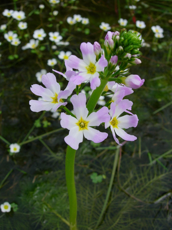
FLORA AND VEGETATION
In mainland France the number of native plants ("Higher plants") is estimated at about 4900. The Brenne Regional Nature Park is home to 1599 of it (amongst them are 300 "Lower plants"). They are consisting of: 26 of France's protected species, 97 of protected species of Central France and of 227 protected species of local interest.
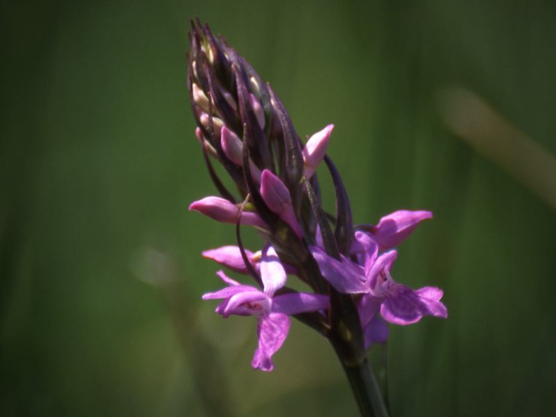
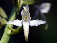
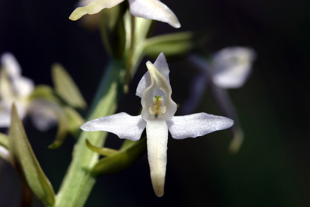
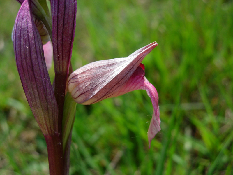
In 2004 the number of remarkable plant sites identified in the Park amounted to 5523. Important to point out is the presence of 46 orchid species.
The Lakes
The presence of this remarkable flora is strongly linked to the various wetland areas of the Brenne. Nearly a quarter of the remarkable flora listed is due to the existence of the lakes and ponds. 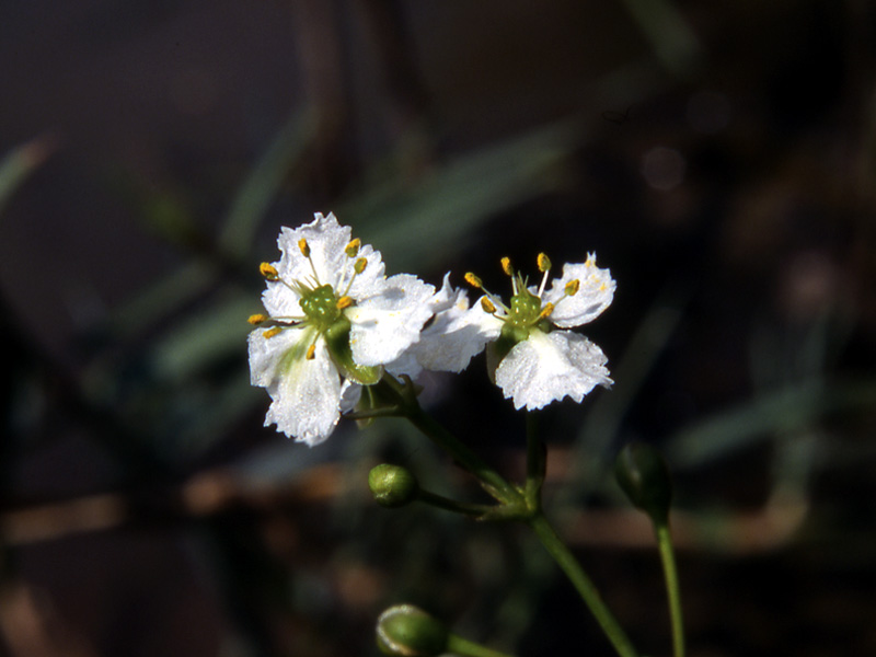 A characteristic of the lakes' vegetation are successive belts of floating aquatic plants which are starting from the center of the lake to spread towards the periphery. Amongst them are Water lilies, pond weed, knot weed or submerged sea grass (reed beds consisting of different species).
Many remarkable species developed in "open waters" like the "Nymphoides peltata/ False Water Lily" and in shallower waters the "Caldesia parassanofolia", the Floating water-plantain...
The yearly "Marnage" (an ancient agricultural practice to add lime to the soil) is important for the flora of the lakes. Annuals (Cyperus michelianus, Baldellia ranunculoides subsp.repens, Eleocharis uniglumis) and perennials (Litorella uniflora, Isoetes velata subsp. tenuissima...) are sharing the grounds subject to the water movements. The yearly "assecs" (lakes left empty from spring until autumn) allowing the development of the Bidens radiate, polygonum bistorta, sorrel, Chenopodiums...) On the dried up sands of the beaches, the Trifolium agri, lotus corniculatus.... are forming coloured belts.
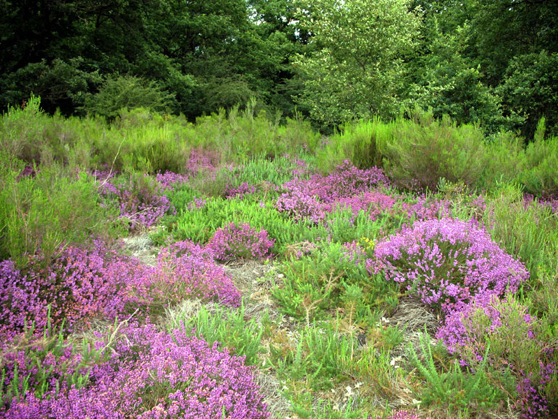
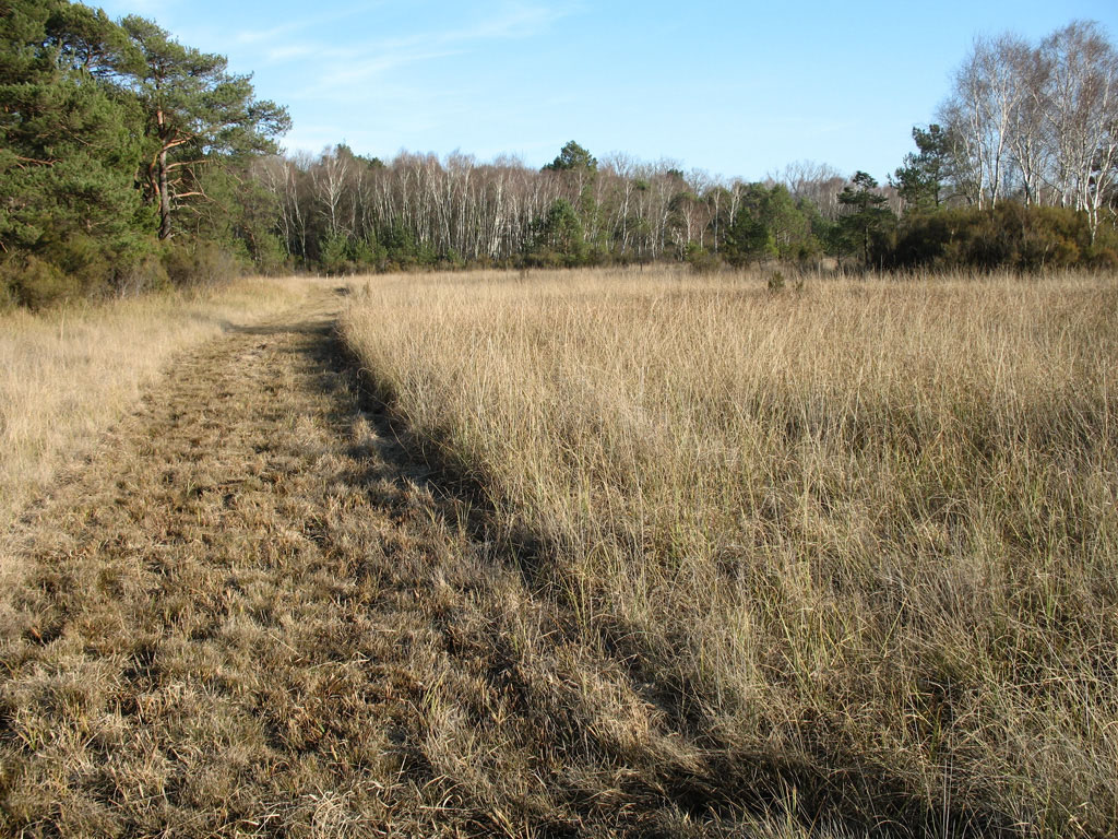
The Heathland
The heathlands covered with calluna vulgaris, Europeen gorse and broom (Genisteae) are stretching over poor soil, sometimes together with blackthorn and spikey hawthorn.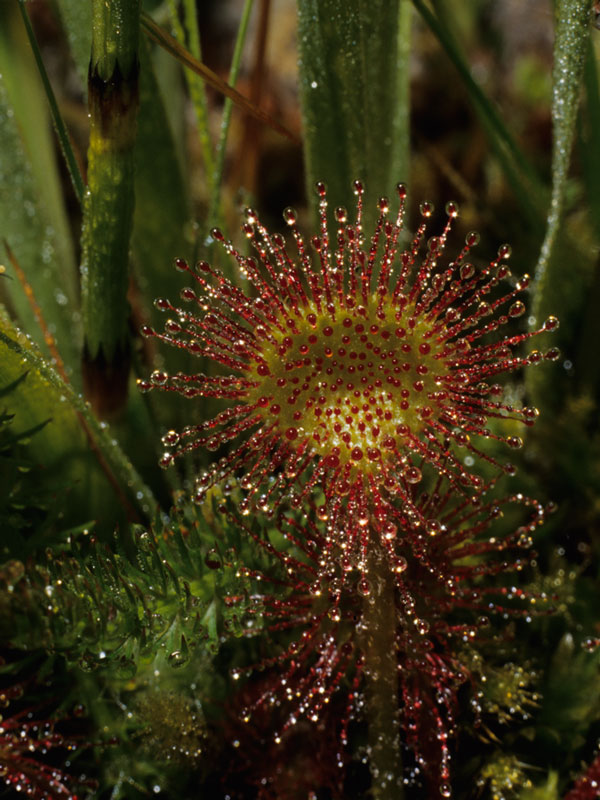 One can distinguish especially:
- The Moorland: rare and spread about, characterised by the Cross-leaved heath (Erica tetralix) and the Gentiana pneumonanth, can be also home to micro bogs with Sundew (Drosera rotundifolia) or the Grassette Portugal (Pinguicula lusitanica).
- The Heathland: a typical landscape, home amongst other species, to the tree heath (Erica arborea) and the European Gorse.
- The dry Heathland, home to the Bell heather (Erica cinerea) and sometimes to the Illyrian Gladiolus, the Rock rose (Halimium umbellatum), the Arenaria montana or the Linaria prlisseriana.
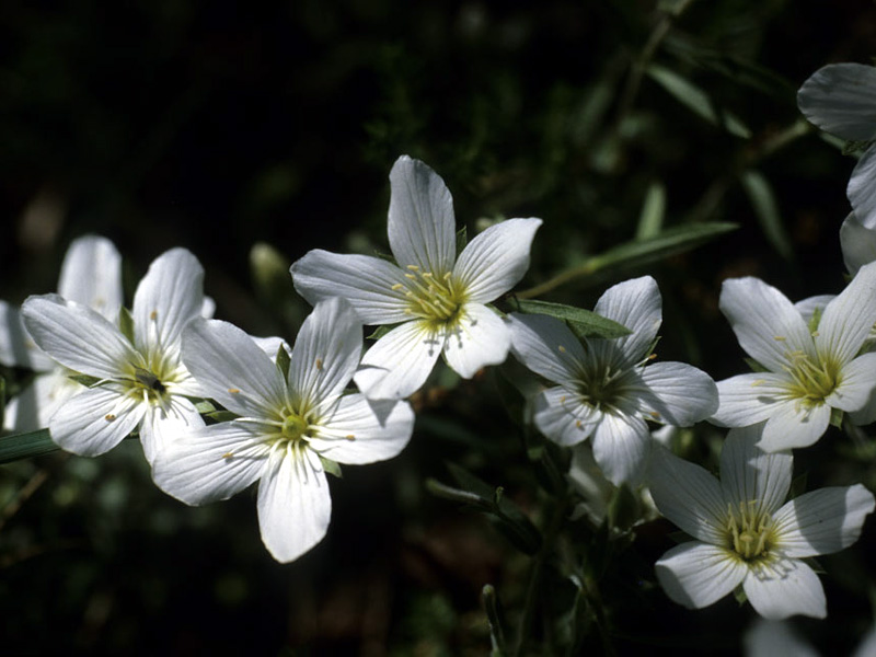
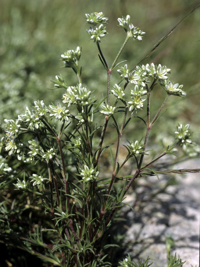
Grasslands on Limestone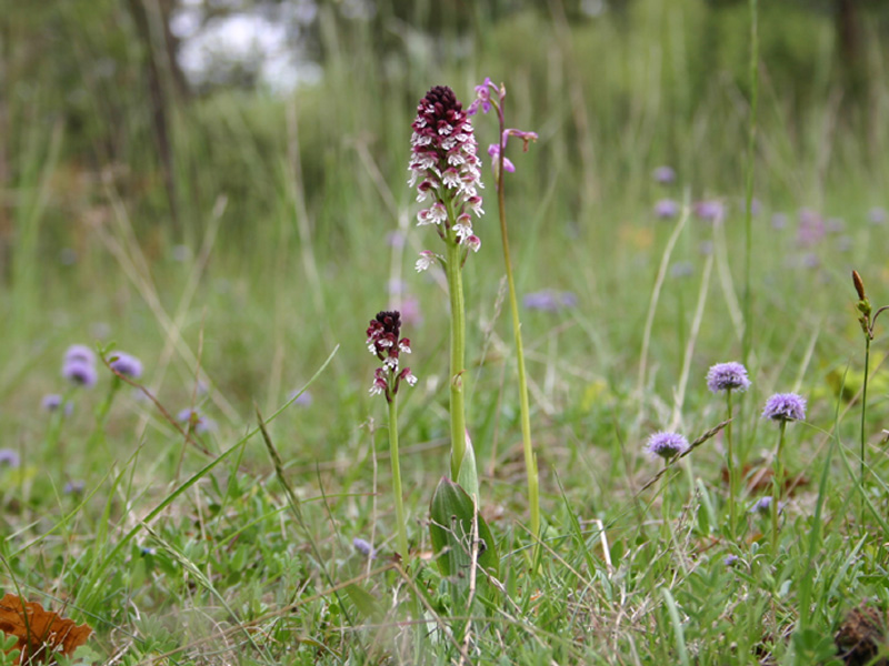 Situated on the slopes of the valleys, they give shelter to numerous adapted species like the Astragalus glycyphyllos. More than 20 heat demanding orchids, growing on chalky soil, are finding plenty of suitable spots; some of them are locally protected species. Many plant species can be found at the northern boundaries of the territory (Knotted clover/Trifolium striatum, Montpellier Maple/Acer monspessulanum, Snowy Mespilus/ Amelanchier ovalis, the Small Bellflower/Campanula erinus....). Finally, at least 350 plant species linked to grassland areas and chalky zones are accounted for!
To be able to expand in such a difficult environment adaptation skills are needed: therefore subshrubs (Halimium and Tencrium montanum), succulents like some stonecrops, etc. can be found... Those specialized plants are able to live side by side only in such an exceptional environment.
Marshland on Limestone
There are only a few remaining marshlands in the Brenne which cover a substantial area. Amongst them are the very remarkable Saw-sedge (Cladium mariscus) limestone marshlands in the northern part of the Park. Between the Sedges an unusual Flora can be observed: the Marsh-grass of Parnassus (Parnassia palustris), Marsh Helleborine (Epipactis palustris), Marsh land orchids and the famous Orchid of the Brenne (Dactylohiza brennensis).
Meadows
According to the soil characteristics three very different types of meadows are existant in the Brenne:
- The cane grass wetland meadow is normally mixed with Marsh pennywort (Hydrocotyle vulgaris), Carum verticillatum, Scorzonera, thistles (Cirsium), etc.,which houses often little peaty areas.
- The mesophilic meadows (where the humidity-drought level of the soil is average), is dominated by Buffalo grass (Anthoxanthum odoratum) and the Yorkshire fog (Holcus lanatus). This kind of meadow has often replaced areas used before for agricultural exploitation.
- The meadows with a poor soil, home to the Tongue orchid (Serapias lingua), are mixing sometimes with siliceous dry grasslands, which contain annual plants, or with dry meadows with Sheep's fescue (Festuca ovina). Those ones are more or less rich in small clovers with a Mediterranean aspect.
Vegetation on Sandstone
The peaks of the "Buttons" (sandstone hillocks) or other sandstone outcrops are housing pioneering plants like Lichen, small mossy plants like Scleranthus and occasionally the European Pasqueflower (Pulsatilla vulgaris).
 Forests
The English Oak (Quercus robur) is a dominating species in the Brenne. Sometimes it can be found in co-habitation with the Irish Oak (Quercus petraea) and most of the time with the Common Hornbeam (Carpinus betulus). In certain areas, pine plantations (common pines, Scotch pines and Corsican pines) have replaced the broadleaf trees. In some places Pyrenean Oaks (Quercus pyrenaica) are present.
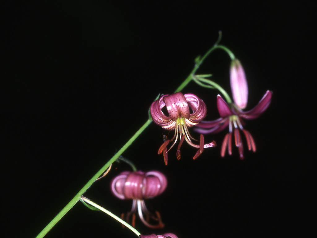
The shady forests of the valleys of the Creuse and the Anglin rivers are allowing the proliferation of ferns: Hart's tongue ferns (Asplenium scolopendrium) and Western Oak fern (Gymnocarpium dryopteris). They grow on their embankments and on its hill side's mountain plants can be found sometimes. These are, amongst several others: the Martagon lily (Lilium martagon), Nectaroscilla hyacinthoides, Sedges (Carex digitée), European Bistort (Bistorta officinalis) ...
EXOTICAL AND INVASIVE SPECIES
Today invasive species are representing the second most important reason for the disappearance of the planet's biodiversity. Therefore it is of great importance to know them in order to fight their propagation.
According to the "UICN"(Union Mondiale pour la Nature) , an invasive species is an "Exotic species of which the introduction, the installation and the propagation are threating the ecosystems, the habitats or the native species due to negative environmental and/or economical consequences and/or negative sanitary reasons".
Most of the time it is human actions which are at the origin of its introductions, either voluntary (commercial reasons, biological control....) or accidentally (via the hulls of the boats...)
Around 1 species out of 100 introduced ones becomes invasive. That means this species is proliferating in its new environment to the point of threatening others, natural habitats or local ecosystems. Most of the time those invasive species have a high reproduction rate, no competitors, no diseases and not enough predators in their new environment.
In Europe the introduction of new species exists since several centuries, but with the increase of global trade we are noticing acceleration! With the consequence that invasive species have gradually colonised the continent and France has not been spared. Aquatic environments and wetland areas are particularly touched by the arrival of those species.
Two common invasive species: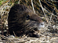 Originally from Southern America, the "Nutria" has been raised for its fur from 1882. When this activity stopped, the animals had been scattered into nature and multiplied greatly. Today they are causing great damage, especially to the embankments and the causeways of the ponds where they dig their burrows.
 The Japanese knotweed has been introduced in France voluntarily in 1939 as an ornamental plant. It can practically eradicate all other species due to a high growth rate and abundant foliage, depriving other herbaceous species and young trees seedlings of light.
Some other species present in the Brenne and their arrival date in France:
- 1786: Alianthus altissima, China
- 1863: Ambrosia artemisiifolia, Northern America
- 1871: Catfish ( Ictalarus sp.), Northern America
- 1877: Sun perch or Rainbow perch (Lepomis gibbosus), Southern America
- 1880 : Myriophyllum aquaticum, Southern America
- 1896: Buddlea or Butterfly trea (Buddleja davidii), China
- 1911-1913: Red Swamp crayfish (Orconectes limosus), Cost of the United States
- 1925: Musk rat (Ondatra zibethicus), Canada
- 1970: Florida turtle (Trachemys scripta elegans), United States of America
Rapid growth, strong adaptability, high reproductive capacity, extrema resistance, etc.: amongst the invasive species present in the Brenne actually, 2 are clearly the most threatening:
The Red swamp crayfish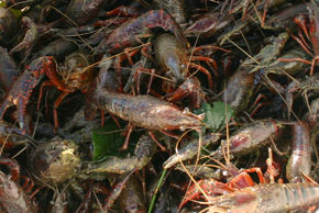
The Water-Primrose (Ludwigia)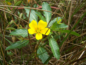
Other invasive exotic species are about to cross "the borders of the Park". Notably the bullfrog, which shows an extraordinary voracity (e.g. an adult bullfrog is able to swallow a young moorhen!) and the Asian hornet which is a great threat to our bees....
Guide of the exotic invasive species of the park
The Parc in brief
The Brenne Regional Nature Park has been found 22nd December 1989, thanks to a strong mobilization of elected counselors and local institutions. Their aim was to fight against the devitalization of their territory and the desire to put in place lasting implementations for local developments. Another reason for its creation was also the acknowledgement of the wealth and fragility of its heritage, the necessity of the protection of a wetland area of International importance, classed by the RAMSAR convention in 1991.
|
Création |
22-12-1989 |
|
1er renouvellement |
10-09-1998 |
|
2ème renouvellement |
01-09-2010 |
| Région | Région Centre |
| Département | Indre |
| Communes | 51 |
| Communautés de communes | 5 |
| Population | 33 000 hab |
| Surface |
183 000 Ha |
What is a Park ?
A "Parc naturel regional/PNR" is a rural inhabited territory, recognized on a national level for the wealth of its heritage (architectural and environmental) but which is in certain ways fragile. For this reason a project to protect this territory had been put in place which includes sustainable development, based on the protection and valorization of its heritage.
The territory of the PNR is classed by a decree of the Prime Minister, based on a report of the Minister of the Environment for a duration of 12 years maximum, renewable.
The PNR is managed by a Mixed Syndicate which regroups all communities which have approved the chart of the Park.
The vocation of a PNR is the protection and valorization of the natural, cultural and human heritage of its territory by implementing innovative political decisions. Those decisions are concerning planning permissions, economical, social and cultural developments, respectful of the environment.
The 51PNR are grouped under the " Fédération des Parcs naturels régionaux de France »
http://www.parcs-naturels-regionaux.fr
The missions of a «Parc naturel régional» are :
- The protection und the management of the natural and cultural heritage
The park is committed to manage its rural areas in a harmonious manner; to maintain the biodiversity of its environment; to preserve and valorize its natural resources, its landscapes and its cultural heritage. - The planning projects of its territory
In integrating local and national planning projects into the territory, the PNR plays an important role concerning various projects and developments. - The economical and social development :
The park animates and coordinates economical and social activities in order to guarantee a quality of life and developments which are respectful towards the fragile environment of its territory. - Information, education :
The park raises awareness concerning its fragile environment, invites its visitors to discover the territory through its educational, cultural and touristic activities. - Experiments :
The park contributes to research programs and its mission is to initiate methods of innovative actions which can be used in another territory (on a national but also international level).
Les Parcs en 50 questions-réponses
The project of the territory
The territory's project takes the form of a charter. This consists of a contract which unites the parishes, the community of communes (communes grouped par geographical order), the county of the Indre, the region of the "Centre", the State and the "Syndicat mixte" of the park (a form of several local governing bodies) for a concerted and consistent management of the territory.
The charter defines the objectives, measures, principles of action, responsibilities and enhancing commitments. It also outlines the protection and the development of the territory due to open negotiations and ratifications between the signing bodies.
The charter expresses the will of all local players to develop and implement a territorial project together. It consists of a written report and a plan which is translated in mapping it accordingly.
Every 12 years the park outlines a plan of action as well as a diagnostic of the territory. This serves to redefine a new project. According to this the charter is renewed (or not) for the next 12 years.
The 2nd of the territory of the "Parc naturel régional" has been concluded at the 1st of September 2010 par Ministerial Decree.
Organization of the territory
The decree indicating the renewal of the classification of the "Parc naturel régional de la Brenne" has been published in the official journal on the 3rd of September 2010. The new " Parc naturel régional de la Brenne" includes 51 parishes, accounts 33700 inhabitants on a surface of 183 000 ha in the south-western quarter of the county of the Indre (population density 18,47 inhabitants, one of the lowest of the "Centre" Region/the average of the county is 34 inhabitants/km²).
Places to visit
Places to visit
Accomodation
Accomodation
Food and drinks
Food and drinks
Nature tourism
Nature tourism
Open-air activities
Open-air activities